Friday, 7 August 2015

Mons, Greenway, La Coste, St Martin de l'Arcon,

Mons, Greenway, La Coste, St Martin de l'Arcon, Heric gorge. About 5km. 1H.30. A super little breakfast walk this morning. Down the blue marked route from the church in Mons.

This is a pretty little concrete road that passes olives, fruit trees and donkeys enjoying the last of the summer's grass. At the bottom turn left and head to the village.

The is a lovely little auberge there were you can enjoy your breakfast coffee or if you prefer to  do what we did buy some of Clermont the bakers super croissants or even better the lovely sticky pain au raisin ones that he makes and take them all the Greenway (heading east) until you get just past the bridge over the River Heric. There is a lovely shady picnic bench there and we ate them hungrily with a flask of hot coffee that we had brought with us. Heaven!

Now, the important bit is out of the way, keep going along the Greenway,There is a super view from the bridge of the gorge d'Heric. through the tunnel and once out into the open look for a little path through the hedge on your left a few metres before you get to a large bridge going over the main road. (it should be marked blue but the stone had been moved again this morning).

Take this little path, it passes through a small vineyard then almost down to meet the road before heading up on another left turn into the trees above. It's a bit tatty here so look carefully for the blue markers. The path goes just above the road and then left into the most lovely old chestnut woods with delightful little stone edged walls.

Follow this path up to meet a larger concrete track below St Martin. (When you see a right turn marked blue, don't take it unless you want to visit St Martin).

Now turn left and head towards La Coste across the vineyards with lovely views of both the mountains above and the valley below. At a junction you will see a yellow marker on your right, this track goes up the hill and then down into La Coste. Turn right and then left to go through the hamlet. At the last house turn right and after the white house with a tunnel go left down a tiny passage to the now dry stream.

After crossing the stream the path descends to a wider track which you cross by taking a right and then left quickly to a small path with lovely views. A second drinks stop for us. This path is still marked yellow all the way to the gorge.

Once there cross the little footbridge and turn left towards the car park. Turn right before the entrance to the parking area and head down the road to a house with railings and some rather tricky marker signs.
Turn right here and up to the cool chestnut woods that lead back to Mons. You will pass the old Bread oven on your way before arriving back at the church. Hope you enjoy it. It's one of our favourites.

Thursday, 6 August 2015

Pezenes-les-Mines.


Pezenes-les-Mines. 6km. 1H.40 I did have my camera with me today (so pictures are winter ones), but it's such a pretty little village with a lovely chateau on the hill above.

The walk is delightful cool down a little shady lane beside a rather dry river bed. The river and it's track are deep in the shadow of the hill tree covered hills making it a great walk for a very hot day. 

The track eventually comes out on the forest tracks around the manmade lake at Vailhan. It's an out and back walk.  The walk starts by parking under the chateau and taking the little track marked with the 3 ton sign. It's the same track all the way, but doesn't look like it's possible to use in wet weather as the river crosses it several times.

Wednesday, 5 August 2015

Cabrerolles.(Castle, chapel) Circuit of La Balaruc and La Borie Nouvelle

Cabrerolles.(Castle, chapel) Circuit of La Balaruc and La Borie Nouvelle. 6km, 2H. Blue, then red/yellow. An easy and most interesting walk. Rather hot in this weather as it was uphill to start with and then we couldn't find a small path that we wanted to take back in La Borie and ended up rather hot and bothered after a scramble down to the stream to find it!

Park in Cabrerolles beside the lovely little church and then follow the blue markers up to the Pigeoner. It's only a very short way off the walk to look at the old building and gives you a grade perspective of the castle above.

Now continue up the blue route to the castle following the route through the ruins with amazing views of the valley below and all it's wonderful vineyards. There is lots to see up here including the old site of an ancient graveyard within the castle walls.

Now go on up to the beautiful 14th century chapel  and drop down to the back of the castle walls. If you don't want to do any more simply turn left here through the west gate arch and enjoy all the information on the flower/plant walk along this route.

Now continue on up the hill on the blue route through a holm oak wood and at a wide col you will see several paths. If you continue on the blue route as we did you will soon come to the little hamlet of La Borie Nouvelle with lovely views over the wooded hills to the pic de la Coquillade.

We tried to make it a circular route but failing in the midday heat we headed back along the little road to the col you can go down the little road as we did or down the Reseau vert yellow/red to the zigzags. (Here we found where our path came out!) Continue on the little road down to where the greenway goes onto a small track to your right, this passes some lovely vineyards with pretty views of the surrounding area.

Turn right onto the road and the church is just around the corner. Some super views down to the coastal plain on this walk. The blue route is part of a longer circuit of the Pic de la Coquillade. 8.4km. 3H30. One for a cooler day I think!

Tuesday, 4 August 2015

Saint-Martin-de-l'Arcon circuit.

Saint-Martin-de-l'Arcon circuit. This is normally started from either St Martin or the Gorge d'Heric but I stated it in Mons. 10.5km 3H 30m. (The circuit itself is 7.5km 3H. Yellow.) Moderate in most books but on a hot day it can be quite challenging, don't underestimate the route, although not long, it's uphill on steep, rocky paths and downhill on even steeper rock ones!


If you want to start in Mons you can by following the yellow/red route down through the woods to the gorge but the route is easily started at the gorge car park. Walk up into the gorge and cross the little footbridge(soupirs). You will see yellow markers to your left. (The walk can be done in either direction).

The route on this path up to the col de Bertouyre takes about an hour (when you reach the blue route, you are about half way up). It's a long way up, but in the shade under holm oak trees all the way up. There are also some fine views of the gorge and the Jaur valley form time to time.

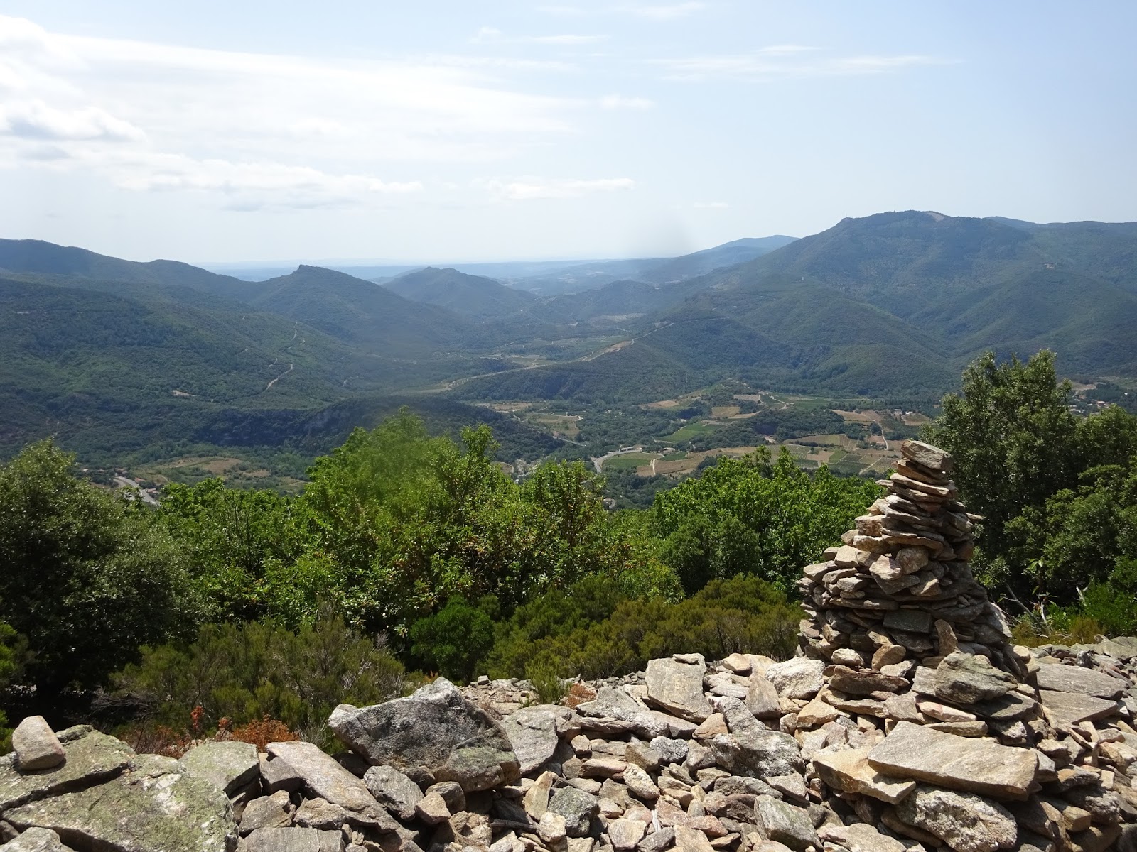
Once at the col keep on the path marked yellow, go past the cairns where you will find some super views of the valley below, you may even like to picnic at this spot.

It's not a lonely route in summer and you may find that you pass people from time to time on there way up and down the mountain. Now take one zigzag up on the route and you will come to a sign post to St Martin.

Turn left onto this path and descend carefully as it can be difficult especially at the beginning. As you get lower there are some beautiful views of the little village of St Martin with its lovely church below. Now the route descends through old chestnut woods then crosses the stream which is dry at the moment; a bonus as the bridge is still broken from the winter storms. In the village you can stay on the yellow markers which go up to the church parking area but I cross the road and turn right. You will see a gap between two houses, the path is marked blue, turn left down here.

It bear right between little stone walls and drops onto the yellow route once again, cutting off the corner. Now turn right onto this track and continue through the chestnut woods, old vines and taking a right hand slope you will arrive in La Coste. Turn right and go through the village taking a right again before passing under a white house.

Now turn left down a small path to a dry ford and up through the woods again. The path drops to your right onto a wider track before taking a left onto a small path. A lovely view here, my coffee spot! Now follow this little path back through the woods to the gorge. There is a cafe in the gorge car park.

If you are going to Mons don't forget to turn off at the railings and the confusing signpost. It's just another km to Mons. Do take plenty of water with you and if you have a dog some for them on the upper section. Lower down you will pass a couple of streams. Enjoy.

Monday, 3 August 2015

St Martin du Froid, from Mons.

St Martin du Froid, from Mons. 16km, 5h.30 with several short breaks. Yellow/red markers. This is a magnificent walk and you can make a circular walk from the col de Bardou on your return by either taking the route via the Gorge d'Heric or Bardou.

Start in Mons (just above Mons la Trivalle). Park by the church and walk up the route marked yellow/red through the village. The route goes up between some old stone houses at the top of the village and enters the chestnut woods. Now stay on this path for about 5km until you reach the col de Bardou. It's a lovely path under col trees for most of the time.

At the col, cross over the GR7 and take the left side of the path ascending from the col which is signposted for the chapel 3km. It doesn't seem far but don't underestimate this route. It's a gentle path of lovely rounded stones, a real old donkey path, but it's all uphill all the way and there isn't a lot of shade on the last zigzags. There is also no water in summer on this route so if you have a dog with you, you will need to take water for it too.

The views just get better and better as you climb up each zigzag. From the last zigzag you will be able to see the coast, Pyrenees, Gorge d'Heric, Caroux, Aret, and the Mont Gros. It's just so very beautiful. Breathtakingly. Soon after this you will see little pines marking the top of your route and a couple of cairns direct you to the path up through pine trees to the chapel St Martin du Froid.

It's amazing how much cooler the air is up here and it makes a delightful spot for a picnic too before your descent. (A lot of people like to make a circular route of this by continuing on the GRP across the forest and then down to the Montahut. It looks a long way on the map but you can cover a lot of ground quickly in the level forest). I really enjoy the descent over the same course as you can now enjoy the wonderful views without being out of puff!

Once back at the col de Bardou there are a number of routes that you can take and there isn't a lot of difference in the distance. Either turn left down the GR7 to Heric and walk through the beautiful gorge(this way there are two cafes on route!), also you can turn right and down towards Bardou,

There is a little yellow spot route that you can take back this way that comes out near Pibons and then takes the little road into Les Pradals.

Or finally retrace your route down the yellow/red route back to Mons. (If you want a challenging end to your route with more spectacular views take the yellow spot route to the col du Roujas and the the red one past Gleyzo and Peyris). A wonderful route. Enjoy.

Sunday, 2 August 2015

Saint-Martin-de-Dounaro. Prades-sur-Vernazobre.

Saint-Martin-de-Dounaro. Prades-sur-Vernazobre. 8.7km. 3H. Blue markers. A well marked trail with fine views of the Caroux and the hills around Roquebrun, Cessenon and St Chinian.It should have been done in the opposite direction, but this is what we did.

Park next to the Mairie on the D177 and walk in the direction of Berlou on the road. After a short time you will see a small track on your left which bears to the right before turning left once again in a very short space of time.

This track is a board one in pine trees but offers little shade on a hot day. You will start to see views of the Caroux quite soon and then there is a turn to the left. This is where we decided to do the walk in the opposite direction by walking towards Marignes. Here the path turns left sharply uphill on a small track. It soon becomes quite difficult as it turns to meet a larger track.

At this point you can shorten the walk by turning left or continue with the main route by turning right. The track continues uphill passing another track to your left and finally reaching a broad junction where you turn left and on up to the top of the hill past several hunters towers. Now you will see a sign post.

If you wish to go on to visit the ruins of the little chapel as I did, it's only another 170m further uphill. The chapel ruins are very small and have been rebuilt to show the former area it covered. Now back to the signpost and on down on the top path (which would have been a left turn if you didn't visit the chapel).

You will pass the two tracks that join from your left and keep on this track until you reach the point where you began the circuit in the pine forest. The track turn right and retraces your route to Les Boriettes at the road junction.

Now turn right on the road to reach the car park. Good view, especially on the second path of the route but probably not a good one for a very hot day! Enjoy.

Saturday, 1 August 2015

La Borie Basse, Colombieres-sur Orb.

La Borie Basse. 6km, 2H no markers. Easy. This is a lovely varied walk with wonderful views of the Caroux and Orb valley. It uses tracks through forest, vineyards and olive groves, old drailles and finally the Greenway. Start by parking at the parking/picnic area for the Chapel of St Colombe on the D908. This is how we did the walk, but it's a reverse of the one in French below.

Start by taking the track sign posted Sevirac to the left of the chapel and continue up past a stone shelter and two small cabins. The views across to the Caroux and the Gorge de Colombieres are wonderful here. Now turn right and walk across a lovely olive grove. The track keeps going up now through chestnut woods.

Keep to the main track as it crosses a small draille leading up into the mountains. Soon you will cross a small stream and the track now contours around the hill (it was here that we met a family walking with donkeys on their holiday), keep right here at Le Pio (the left track goes up to le Vernet). Now the track descends through lovely pine woods, scented but last nights storm and fresh in the morning's breeze.

The last part of the walk now continues to descend, but by way of an old draille with high sides. These were used many years ago to prevent cattle and sheep entering the crops as they were taken up to the higher pastures, no longer used for this purpose they still look very beautiful. You will soon arrive at the little hamlet of La Borie Basse, where you head through the middle of the houses observing the crosses atop the first building.

Now continue on the track past the vineyard and one more house and you will see a bridge below marking the start of the greenway/piste vert section.

Leave the track at a right turn before the bridge and continue on this until it meets the greenway where the main road is crossed.

Now continue on the Greenway for sometime and take the GRP path (yellow/red markers) to your right up the car parking area at the Chapel St Colombe. Enjoy the walk, we thought it was lovely.