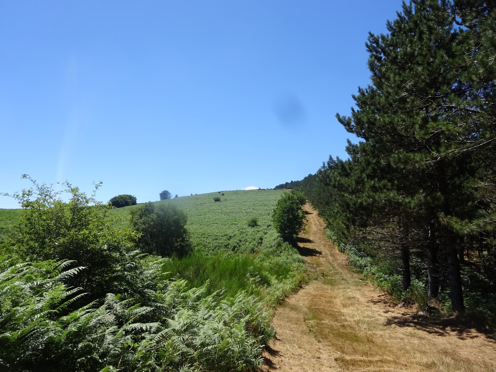
Circuit of Cassagnoles, 7km, 2.15H easy. No waymakers. Such a beautiful walk on the old paths above St Etienne d'Albagnan. On this route you will enjoy glorious views of the Espinouse mountains, Somail and the beautiful Caroux.
The route is very varied and uses track, tiny stone paths, twists up open hillsides and through lovely old chest woods.
There are little hamlets, streams and even a magical pool to side and picnic beside.
Start by drive up and through the tiny hamlet of Cassagnoles,parking can be found in a large area where there is a turn around place.
Walk back down the little lane and on your left you will see a small rough track, follow this up and around past a small stream.
There is a short cut on a tiny path just past this turn over a broken wall but we continued on the track down along the wall with lovely open views across the valley to slopes that in summer are covered in heather.
When you are above the mill buildings below the track turns left and descends to wider track (the track is quite undefined here).
Once onto the wider track turn left and go uphill past a little clearing with a hunters lodge and tower in it.
The bench here makes a good spot for a coffee break, with lovely views down towards the caroux.
Keep going up on this track with beautiful views over the meadows at Pradels and descend down towards Violgues.
Before reaching the hamlet turn left up a steep track and ignore the first turns to your right but shortly at a small col you will find you come to a split in the tracks. Take the smaller one to your right.
This heads towards an area that was once cultivated with vines but is now overgrown. Your view are now to the west.
The track splits again, but be sure to take the more overgrown top track to your right. This goes past a little stone building and between two fields of small olive trees. It doesn't look much like a path here but it is, so stick with it.
Very soon you leave the field and pass into chestnut trees. The little old path has an electric fence on one side, I was not sure if it was working. The path descends to a junction where you take the path to your right (you can hear the stream here and as it gets closer you will see the tiny stone bridge and then the very lovely large pool with little waterfalls.
This makes a wonderful spot for a picnic, so enjoy this little bit of heaven before continuing on the tiny path along through the chestnut woods.
The path comes out in La Calagno. Now descend left at the corner of the building, on a very tiny stone path between two small low stone walls. The chestnuts here are very lovely in open glades with grass under them.
The path itself seems to double as a stream but it's not really wet, just bubbling through the stones. Ignore the left-hand path and keep to the top one which now descends down to join another track leading to a bridge on the left.
Go over the bridge and keep right past the Mas du Rieu (farm). There were loads of sheep going up to the pastures as we came by, a very pretty sight.
This broad track now follow the stream down to a fork in the track. Descend to the right on a small unmade road, pass a couple of houses and back to the car. Very lovely walk.
Showing posts with label Somail. Show all posts
Thursday, 15 October 2015
Tuesday, 28 July 2015
Tour de Lac, col de la Frajure, Fraisse-sur-Agout.
Tour de Lac, col de la Frajure, Fraisse-sur-Agout. Easy 8km. 2H.30m , yellow markings. Parking at the col D169. Start by taking the path south of Mont Lebrousse on the right side of the road after the col.
It is marked by the first yellow marker and leads on a level path first through beech forest and then pine with an occasional view of the lake below through the trees. Once out of the pine woods you will arrive at a place called la Barthe where you will see a small stone building and a freshwater spring.
Now you will be in the open, where you have some lovely views as you curve around the meadows. When you see a small log bridge leading into the woods to your right, do pop into see the menhir, I believe they are about 5000 years old.
It's a lovely quite spot for a coffee stop. Now back on the main path watch out for where the track splits, you will take the track to your right. This path leads through lovely forest of beech and pine for some time.
Keep to the right on most paths and look out for the yellow markers at the junctions. The first two are right turns, then a left at a main fork (but you can go up that one to cut off the corner if you will it comes out at the second standing stone).
There is one more right turn and then the path bears right onto open land. Continue to the top of the hill on a grassy path beside pines to a large stone or rather two piled together (peyre sus autre). This dramatic spot is heaven for a picnic as the stones have a cooling tree to shelter them from the hot sun.
Now continue down the broad grassy path with it's amazing views to the south of the Espinouse all the way down to the Avant monts and the Black mountains in one direction and the summit of the Espinouse in the other. Quite a sight as a blanket of green bracken is laid before you, so inviting in the summer heat. Then path then regains the hill and then down one more time before yet another final climb to the Mourel de Cayrou. Turn right at the next junction (you will see blue markers here too) and then left at a final one. This path will bring you back to the car parking/picnic area.
It is marked by the first yellow marker and leads on a level path first through beech forest and then pine with an occasional view of the lake below through the trees. Once out of the pine woods you will arrive at a place called la Barthe where you will see a small stone building and a freshwater spring.
Now you will be in the open, where you have some lovely views as you curve around the meadows. When you see a small log bridge leading into the woods to your right, do pop into see the menhir, I believe they are about 5000 years old.
It's a lovely quite spot for a coffee stop. Now back on the main path watch out for where the track splits, you will take the track to your right. This path leads through lovely forest of beech and pine for some time.
Keep to the right on most paths and look out for the yellow markers at the junctions. The first two are right turns, then a left at a main fork (but you can go up that one to cut off the corner if you will it comes out at the second standing stone).
There is one more right turn and then the path bears right onto open land. Continue to the top of the hill on a grassy path beside pines to a large stone or rather two piled together (peyre sus autre). This dramatic spot is heaven for a picnic as the stones have a cooling tree to shelter them from the hot sun.
Now continue down the broad grassy path with it's amazing views to the south of the Espinouse all the way down to the Avant monts and the Black mountains in one direction and the summit of the Espinouse in the other. Quite a sight as a blanket of green bracken is laid before you, so inviting in the summer heat. Then path then regains the hill and then down one more time before yet another final climb to the Mourel de Cayrou. Turn right at the next junction (you will see blue markers here too) and then left at a final one. This path will bring you back to the car parking/picnic area.
Thursday, 23 July 2015
Le Sentier Prevert 5km 1H30m and Le Sentier Borias . Fraisse-sur-Agout.
Le Sentier Prevert 5km 1H30m and Le Sentier Borias . Fraisse-sur-Agout. 2H. 6.5km total. Today it was very hot once again in the Orb/Jaur valley so we headed up to the Somail once again. Such a lovely area with high beech forest, rolling farmland and heather covered tops. This walk starts by taking the D14 to the village of Fraisse-sur-agout, and parking at the stade which is found by turning off onto the D169 that goes up to lac de vezoles. You will see the yellow signs leaving the car park. We made the walk up out of the 2 walks from there to make a larger circular one but it is also possible to do an even shorter one of 2.4km that has lots of lovely signs and information to interest children.
After turning right out of the parking area turn right one more and follow a path that leads to a junction. Take the middle path up the hill. (If you do the shorter one you will return to this point).Now follow the path up over the field (there is a tiny small here to cross and down to a track beside the fields edging woodland.
When you reach a junction you will turn left through woodland on a small path. The track crosses a small road now, (if you decide to take the short walk turn left and then right the Arboretum) The longer walk heads up to some lovely beech woods where you will see the large stone monolith, keep left and you will see the tiny path through the trees just after the place where children have been making bivouacs. The little path joins a larger track and just before the road you will see a little path to your left so you can avoid walking on the road.
Soon you will see a small path to your left over the heather tops. There are amazing views up here of the whole valley. Take this path as it decides down to a junction. (The path to your left is the way that the shorter route takes, it will follow this route and then turn off just before the arboretum) . Now turn right and follow the grassy track to the beautiful little arboretum.
This is a delightful place to rest on seats under the trees. It was laid out in 1984 and again in 2003 by the children of the village who undoubtedly made a lot of the painted information boards on the first part of the walk. It's only a small area, but beautifully kept and has a spring for thirsty dogs. (Although there are 2 more sources of water along the way). The small arboretum has ginko trees, broad leaf oaks and many others, each with little information plates below them.
Now cross the road to a track on your right with recycling bins at it's entrance. Col du Triby. The yellow Le Sentier Prevert signs turn off to your left here and the track runs parallel with the road for sometime before joining the road as it descends into the village.
The Le Sentier Borias, also marked yellow, goes straight on the track following the yellow/red markers to a small path ahead. (Don't turn left at this junction, keep straight on down the side of a field and you will see a tiny path to your left very soon that hugs the edge of the field. This goes between trees and emerges onto a track which it crosses and goes straight back into another tiny path. Soon the path descends into the tiny hamlet of Le Fau (which means Beech in Occitan I believe). After reaching the road, follow it until just before the stream and then turn left up a grassy path beside a building to a junction of paths where you turn right.
Here you will see more lovely views and pastoral images of country life. There were sheep crossing a little stone bridge below us and sheltering from the midday sun in the gentle shade of beech trees, chestnut horses and rolled hay bales left on honey coloured fields to dry in the summer sunshine. It's a delightful place to picnic, watching and listening to the whir of the wind turbines. The track contours the golden hillside and after passing a large farm descends to the road. Finally turn right to complete the walk and find the car park. Enjoy, it's a very lovely ramble.
After turning right out of the parking area turn right one more and follow a path that leads to a junction. Take the middle path up the hill. (If you do the shorter one you will return to this point).Now follow the path up over the field (there is a tiny small here to cross and down to a track beside the fields edging woodland.
When you reach a junction you will turn left through woodland on a small path. The track crosses a small road now, (if you decide to take the short walk turn left and then right the Arboretum) The longer walk heads up to some lovely beech woods where you will see the large stone monolith, keep left and you will see the tiny path through the trees just after the place where children have been making bivouacs. The little path joins a larger track and just before the road you will see a little path to your left so you can avoid walking on the road.
Soon you will see a small path to your left over the heather tops. There are amazing views up here of the whole valley. Take this path as it decides down to a junction. (The path to your left is the way that the shorter route takes, it will follow this route and then turn off just before the arboretum) . Now turn right and follow the grassy track to the beautiful little arboretum.
This is a delightful place to rest on seats under the trees. It was laid out in 1984 and again in 2003 by the children of the village who undoubtedly made a lot of the painted information boards on the first part of the walk. It's only a small area, but beautifully kept and has a spring for thirsty dogs. (Although there are 2 more sources of water along the way). The small arboretum has ginko trees, broad leaf oaks and many others, each with little information plates below them.
Now cross the road to a track on your right with recycling bins at it's entrance. Col du Triby. The yellow Le Sentier Prevert signs turn off to your left here and the track runs parallel with the road for sometime before joining the road as it descends into the village.
The Le Sentier Borias, also marked yellow, goes straight on the track following the yellow/red markers to a small path ahead. (Don't turn left at this junction, keep straight on down the side of a field and you will see a tiny path to your left very soon that hugs the edge of the field. This goes between trees and emerges onto a track which it crosses and goes straight back into another tiny path. Soon the path descends into the tiny hamlet of Le Fau (which means Beech in Occitan I believe). After reaching the road, follow it until just before the stream and then turn left up a grassy path beside a building to a junction of paths where you turn right.
Here you will see more lovely views and pastoral images of country life. There were sheep crossing a little stone bridge below us and sheltering from the midday sun in the gentle shade of beech trees, chestnut horses and rolled hay bales left on honey coloured fields to dry in the summer sunshine. It's a delightful place to picnic, watching and listening to the whir of the wind turbines. The track contours the golden hillside and after passing a large farm descends to the road. Finally turn right to complete the walk and find the car park. Enjoy, it's a very lovely ramble.
Subscribe to:
Posts (Atom)