Sunday, 17 May 2015

Source de Frejo, Olargues. A walk along the Piste Vert, Languedoc.

A lovely easy walk with a beautiful; picnic spot too. 3km. 1H. Park on the Piste vert at the Source de Frejo car park. 

It's only a short drive from Olargues towards St Pons. Don't go down to the waterfall. Take the steps down to the Piste vert and turn left over the river to Olargues. 

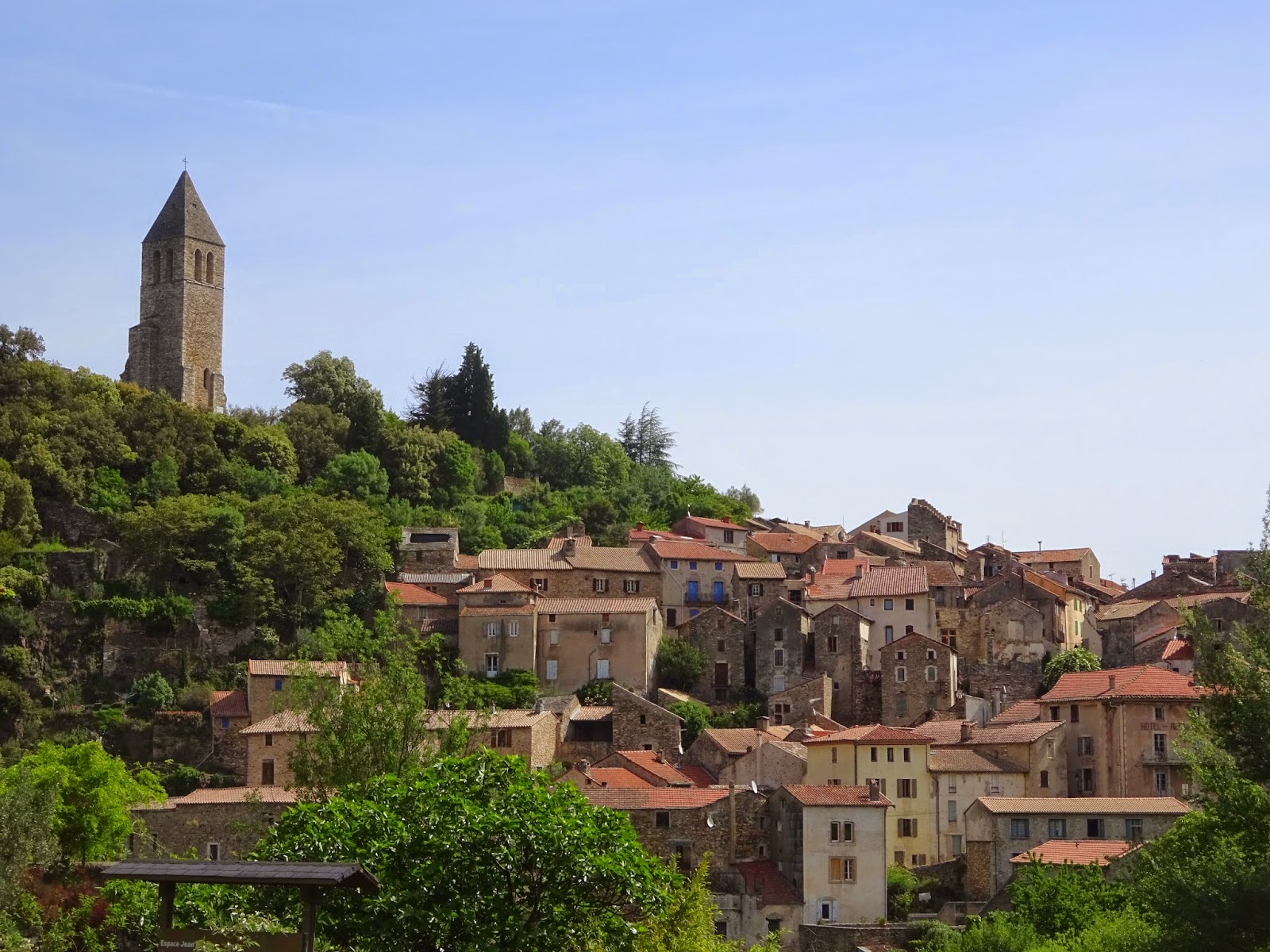
It's a lovely little walk of about 1.5km each way. Olargues is very pretty and has some lovely little bars, restaurants and if you’re lucky like us a little fete might be on. 

If you go right down to the red bridge there is a lovely new pizza restaurant that has lots of nice new seating outside. Return the same way but after you get back to the car park go over the little green bridge and through the pretty meadow/orchard to the waterfall. 


There is a little beach there and you can swim in the deep clean water under the falls. Very, very nice. 


Saturday, 16 May 2015

Round the Etangs at Peyriac de Mer. A coastal walk in the Languedoc.

Round the Etangs at Peyriac de Mer. 6km. The walk on the tops is about 8km. Yellow markers in part, 2H. This is a beautiful walk with lovely views all around the route. Wonderful birds on the Etangs and beautiful wild flowers too.


Park in the centre of the village beside the water and you will see the walks board to the left of the play area. Take the boardwalk and follow it until it comes to a right turn at a wall. Follow the wall pass a stone building(information centre) to another car park.

If you want to do the longer walk on the hill, exit the car park through the gate and take the upper path on your right(this path has views down to Bages and there are a number of paths that you can follow. If you want to walk beside the water stay on the lower track on your right. This path stays beside the Etang with vineyards to your left and the water on your right. Finally you come to a place where you will see a yellow cross. 

Go straight on past the cross and keep beside the water. The path eventually goes up to the top of the hill and joins the upper path near a yellow sign post. Keep straight on and cross the little road at the top. Follow the wooden post along the top of the hill. The views in both directions are wonderful here, out to see and back to Peyriac de Mer. 

The track bares right and past views of the little beach. You can go down for a picnic on the beach (not yesterday as it was so windy we could hardly stand). We followed the yellow markers over to the other hill. There is a way up to the viewpoint on your left if you want to (0.3km). Otherwise continue on the little path as it comes down off the hill and joins the road at the causeway. 

Now you can either go back to the car park across the causeway or take the little path beside the Etang on your right. The path finally crosses a little bridge. After this you go up over the hill and cross the Etang to complete the walk on the lower path.Return the same way.  

(There is another route around the edge of the etang after the little wooden bridge but it's closed for the spring as the birds are nesting and the boardwalk is closed on this side as it's broken in two places at the moment. 

Friday, 15 May 2015

Les Trois Tours, a walk in the Languedoc.

Les Trois Tours. 5km/2h .A delightful walk starting in the lovely village of Faugeres.   There a several car parks in the village but the walk starts near the church in the centre. Follow the yellow markers that take you up hill to a junction.

Here take the right turn and then after a short distance you will see a tiny muleteer’s path to your left. This is a little steep but is the only uphill section on the route. At the top of the hill you will see the three windmills and it is possible to climb one and get an even better view of the surrounding area. From here you can see the coast, 

Pyrenees, Avant Monts, Caroux and the Mountains of the Orb. Now go to the left past the windmills and you will follow a wide track down to a junction where you turn left (there is also a wild flower trail if you rather take that) In a short while you will come to a left turn at a water tank. This begins the most fascinating part of the walk. 

You will see a quite a number of beautifully restored and named capitelles (the name for small circular sheep herders dwellings made of stone. They are about a 1000 years old and have little interconnecting fields, rung with stone walls. There must have been quite a community up here, with a structure of wells, homes and fields where they grow chick peas in this harsh environment. The track goes right now (if you take the left turn it will take you to the village more quickly). 

There are several more fascinating capitelles and then you will see a tiny path on your right. Take this and you will come to a remarkable junction. The junction is called "The Frog" and you will find him to your right. This is where two important Chemin came together and you can imagine mules on the small tracks here with sheep sheltering in their fields. 

Opposite this path you will see another small chemin leading towards the village. Take this and you will be at a junction at the top of the village, bare right and follow the yellow markers through the village back to the car park. No one called not love this walk, even children.

Thursday, 14 May 2015

Les etangs de la Malhaute, Thezan-les-Beziers. A walk along the river Orb in the Languedoc .

Les etangs de la Malhaute, Thezan-les-Beziers. (Blue walk is 4km very easy 1H15)Our walk 6km using part of the blue walk and continuing along the river to join the walk at its turn around point. 2H.  

A lovely gentle walk starting at Canteranes, in the little parking area.Lots of butterflies, birds sound like a tropical forest there and lovely wild flowers. On the walk you pass an old cross, the domaine of Aspiran de Ravanes, of visigoth origin and very old chapel. Lovely views up to the Caroux, Avant Monts and the villages on the hills around. 

The blue walk goes in the opposite direction but this is what we did. At the walk sign turn around and walk down into the trees towards the little marshy lakes, they were made from old gavel quarries and are frequented by lots of happy fishermen. 

The birdsong is wonderful here and it's cool under the trees. The little path winds through the ponds, to the river. Turn left at the river away from the walk (4 on the map) and follow the river around until you come to a barrage. 

At the barrage turn right onto a small track that then turns left onto a little road and bares left onto another small track a little further. Turn right onto a track beside vineyards and this turn reaches a junction were you take the little road in the middle. 

Walk up here until you reach the second right turn onto a small track leading to the domaine of Aspiran. Continue past the houses and bare left at the second house. The chapel is in the trees here.Turn right onto the track, there is an old cross here. 

Walk about 2km down the track which turns into a little road after a while. It's all wheat fields and vineyards here, horses too. Then right to the cars.  

Wednesday, 13 May 2015

La Croix des Prairies. Puimissom. A walk in the Languedoc.

Puimisson. The way of the crosses. 7km, 2H Blue markings. (The yellow walk is 11.5km, 2H.45, can be biked in 1H) The blue walking route is shorter. Lovely walk through vineyards and olive groves, opening on pechs, hillsides and plains. 

There is a lot to see if you do the yellow route with a chapel, an abbey and two châteaus, The walk begins in the village of Piumisson and the 12 century Feudal Château. Follow the yellow bike markers or blue if you see them down through the village heading south-west) to the where it becomes fields. 

You will see a sign for the start of the walk near the pech (A small ridge rise). The path starts as a grassy track and then narrows as it follows the contours of the ridge. It then crosses a track and goes into the small grassy and overgrown path running between vineyards (it's not a problem, they are only wild flowers). 

There are two lovely domaines here. When you reach the edge of Pailhes you will come to a little road which takes you up to the D154. At this junction turn right and walk a short way down the road until you see the track on you left. 

Take the track and keep to the right at the house if you are following the blue path (this is where the blue path reappears) or turn left to do the longer walk that takes you to the chapels. Keep walking down this track as it descends off the little ridge. There are more beautiful views of the Avant Monts up here and you can see the Caroux too. 

At the bottom of the track turn right onto a wide track between the vineyards and follow it all the way back to Puimisson, passing a lovely cross on the way and enjoying the views of the Chateau. The yellow route returns this way too, but then turns left just before the village to enter the village from the north via the old Abbey of St Joseph of Montrouge. 

It's a lovely old circler village with some lovely little streets, little shops in the village square and a little bar too. On the walk you will see lots of wonderful wildlife, including orchids, deer, butterflies and other beautiful wild flowers.

Monday, 11 May 2015

Les Sagnes. Chapel of St Martin des Oeufs. Olargues. A pretty short walk in the Languedoc

Les Sagnes. Chapel of St Martin des Oeufs. Olargues. The whole walk including the hamlet of Le Cros is 7.4km 2 Hours but with my poorly ankle it took us a while to get to the chapel and so we took a return short cut and ended up going down a very pretty route but not really a good one for me. Our walk was about 5km 1H.30. (not including a lovely breakfast picnic at the chapel). No markings.

Park on the D908 near the picnic area or walk over the bridge and take the first little concrete lane on your right. Lovely views looking back of Olargues. Continue on this beyond the houses and you will reach a junction.

Turn right onto the track with lovely views of the Espinouse. Ignore the any other tracks at vineyards and keep right at a fork, climbing up the main track. ignore vineyard tracks that go through the vineyards to the village of Mas du Gua.

The main track winds up though the woods now keep left at the next junction and you will soon come to the chapel of St Martin des Oeufs. It's a very pretty chapel and well worth a visit (with it's shady picnic table it make a good spot for a picnic too).

Now on other occasions we have carried on to Les Codouls, Les Sagnes and Le Cros before descending into the Rouilouse ravine and back to Olargues but this time we merely turned around and went back to the first junction but taking the left turn instead. The track has lovely views here up to the Montahut, across to the Caroux and down the Jaur valley.

The track bares right and goes through some lovely old vineyards that are high up here on this beautiful spot. Take the right track at the following junction that leads around the rocky viewpoint and head back into the pine trees.

It's very tricky to find the little path leading down through the pines, but you will locate it by looking for a pile of stones beside a tree on your right. Follow the little footpath down through the recently burnt undergrowth in the pines (it's quite steep, I had to do most of it on my bottom due to my damaged ankle, but I'm sure you will be fine) and you will come out on the little concrete lane that you started on.

Turn left and head back to the village of Olargues. Olargues has some lovely little restaurants, bars and even a new pizza restaurant by the post office. There is a village shop, a delicatessen, bakers and some great little shops and artist studios to enjoy too. Enjoy.

Sunday, 10 May 2015

Vignes et patrimoine Saint-Genies-de-Fontedit. A walk through the vineyards in the Languedoc.

Vignes et patrimoine Saint-Genies-de-Fontedit. 14km/ 4H40 (we did 6.5km/ 2H.30 with a little picnic stop).Blue markers and well-marked out. A cycle route too.  

Park in the village behind the school and walk into the centre turning right and at the first right turn There is a cross here in the middle of the road (rue des Salleles). 

Walk down this little road past the houses and another cross where the road turns into a track at a right turn (water reservoir). The track although a little climb has lovely views up here of the village and the beautiful snow covered Pyrenees in the distance. 

Turn left onto another track with pretty flowers beside the track and almond trees too. You will soon see a marker for another left turn, with a little stone house to the right of you before you reach the road (D16). 

Turn right onto the road and walk about very short distance up the road before turning left onto a small track. The fields of wheat here were full of red poppies and looked wonderful against the blue sky. We picnicked beside the vines under the tree and enjoyed the lovely views, birds and the odd bee while life drifted by. But the sun was getting hotter so on we went.  

The track continues between more vines before turning left and quickly right. Now done another track to a left turn and a right just before a house onto a path.There are views of the ruined windmill up here.  At the bottom take a left around a corner, beside a field of vines. 

You are in a little valley here and the views of the hills (Avant Monts and those to the west are really pretty). The track is stony here and descends to come close to a bridge. Bare left and join the D154E3. After a while you will see markers for the route turning to the right where you can visit the chapelle saint Fulcran but it was too hot and my foot had had quite enough for one day. 

So we decided that we would keep the rest of this lovely walk for another day. I think the rest of the route will be around 7.30Km and goes around the fields in the lower part of the village. 

We stayed on the road into the centre with lovely views of the churches little green roof, shinning in the hot afternoon sunshine and headed for the coolness of the little streets. Lots of pretty streets on the route and the village appeared to have a good shop and at least one pizza restaurant.