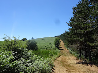
It is marked by the first yellow marker and leads on a level path first through beech forest and then pine with an occasional view of the lake below through the trees. Once out of the pine woods you will arrive at a place called la Barthe where you will see a small stone building and a freshwater spring.
Now you will be in the open, where you have some lovely views as you curve around the meadows. When you see a small log bridge leading into the woods to your right, do pop into see the menhir, I believe they are about 5000 years old.
It's a lovely quite spot for a coffee stop. Now back on the main path watch out for where the track splits, you will take the track to your right. This path leads through lovely forest of beech and pine for some time.
Keep to the right on most paths and look out for the yellow markers at the junctions. The first two are right turns, then a left at a main fork (but you can go up that one to cut off the corner if you will it comes out at the second standing stone).
There is one more right turn and then the path bears right onto open land. Continue to the top of the hill on a grassy path beside pines to a large stone or rather two piled together (peyre sus autre). This dramatic spot is heaven for a picnic as the stones have a cooling tree to shelter them from the hot sun.
Now continue down the broad grassy path with it's amazing views to the south of the Espinouse all the way down to the Avant monts and the Black mountains in one direction and the summit of the Espinouse in the other. Quite a sight as a blanket of green bracken is laid before you, so inviting in the summer heat. Then path then regains the hill and then down one more time before yet another final climb to the Mourel de Cayrou. Turn right at the next junction (you will see blue markers here too) and then left at a final one. This path will bring you back to the car parking/picnic area.


No comments:
Post a Comment