Monday 31 July 2017

Le Devois, Graissessac.

Le Devois, Graissessac. Yellow. 5.30h/12.5km or 2h/6km. We enjoyed the shorter walk. This is a beautiful walk on lovely old paths with wonderful views. It's a steady climb up through pretty woods and then follows a stream and ravine back down to the village. The walk starts by park next to the cemetery and walking back down to the edge of the village. Turning left onto La Rue de La Roque. The little path zigzags for a bit and then crosses a wider track. It steadily climbs to reach a house. La Maison des Cazalets. The col here is lovely, with wonderful views. The track turn right and continues to reach a junction of tracks. Here the variant turns left onto a lovely little track through the chestnuts (tank of water for dogs here). At the head of the valley, you come to a ruin and the path turns down from here along the edge of the ravine/little stream. There's plenty of water for dogs here. Keep following this path down to cross the stream next to a house and the junction of the main walk. This track now returns you to the village.


Saturday 29 July 2017

La Chapelle Notre-Dame-de-Tredos, near St-Etienne-d'Albagnan.

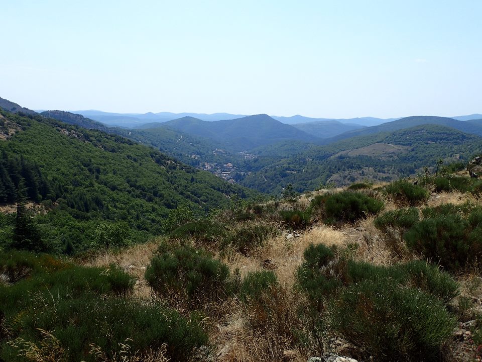
La Chapelle Notre-Dame-de-Tredos, near St-Etienne-d'Albagnan. (13km /4.30h/yellow). (This is a lovely walk that starts in Riols and takes a route up to the chapel on a lovely ridge, then returns on another ridge back to Riols. It can also be done by a longer route starting in Riols and taking the voie verte to Premain, then up on the GR to the chapel before returning on the return yellow route, this route is 17km/5h). Knowing this is a lovely high, undulating route we decided to go up to the chapel where there is a place to park and then walking the route to Mas du Rieu only the inner ridge with it's beautiful views. Lots of wonderful butterflies and wild flowers. We were walking back when a large mother wild boar was standing in our path, I quickly called our collie before two tiny, fluffy baby boars followed her. A lovely sight. Looking forward to doing the full walk in the autumn when it's a little cooler.


Friday 28 July 2017

Sentier de chevreuil, La Gante, Labastide-Rouairoux

Sentier de chevreuil, La Gante, Labastide-Rouairoux. This walk is found by taking the D64 up from the little town on the route to the lakes. After a wide bend in the forested road you will come to a very large dolmen (tomb). There is a small parking area here with stone picnic benches. (The main walk is 12km but the smaller one appeared to be around 7km. There are several new walks up there including a yellow walk, but I'm not sure where it started, possibly down in the valley below. The route that we took was an old path marked with yellow deer symbols.The walk was beautifully managed for the first half and then the route appeared to vanish. When we finally found it again it had become abandoned but still very beautiful. I think the new yellow walk must have replaced it). So here we go "Sentier de chevreuil" following little yellow deer. We loved this route, so cool and pretty. No views but butterflies and flowers, a cool breeze and 20c (It was 33c back at our house in the valley). Once you have parked up, turn right and follow the wide track to reach a tiny path to your right leading into the trees. The trees are marked here both with GR and yellow deers. The path makes and circuit up to the ruins of a tiny chapel and then skirts around La Gante. It heads north through beautiful woodland and then reaches the PR yellow/red. We followed the route to reach a wide track that is also a cycle route but it was here that we found it difficult to find the continued route. Finally turning left and then finding another deer sign on a tree we followed a few orange markers into the trees and then picked up the deer signs once again. It went over a dry stream and the along a small ridge to find some old wooden steps leading down the pretty little wooded ravine and follow a tiny path that went up to an old ruin. The path should go behind the ruin but it's blocked so look for a down path a very short way on. This picks up the deer signed path to reach the bottom. Carry on until it come down onto a wide path marked yellow and Red/white. Now turn left to cross the stream and continue up towards the parking. Don't follow the deer signs on your right as this is the longer route. Continue on and shortly you will arrive at the dolmen again. Great cool walk but very tricky to follow. Fun though.


Wednesday 26 July 2017

L'Ermitage Saint-Etienne, St-Nazaire-de-Ladarez

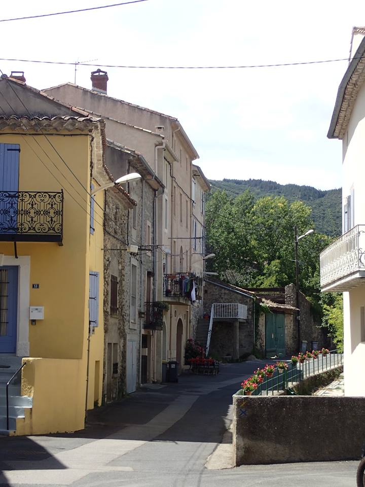
L'Ermitage Saint-Etienne, St-Nazaire-de-Ladarez. (5km, 1.30H, blue). Our walk was slightly different as we took the easier but longer track back down. 8km 2H, but with great views all the way down that you don't see on the little path up. The walk starts by parking in the car park near to the church. This is also the start of the walk. Walk through along the edge of the park and you will be in the middle of the village opposite the little pizzeria. The walk the takes a small path at the end of the hoses to your left. Follow this little rocky path as it crosses between the track several times. The little path reaches some ruins that have a number of vans parked near them, here you descend to a junction and keep right following the blue markers. The route continues up quite steeply now until it reaches the track once again. Turn left to come to a parking area and take a small left turn that goes up to the hermitage. Wonderful views up here and a sweet little chapel. Now descend the same way. If you want to take our route with great views it's only a little longer and much easier on your knees. After the vans at the ruins you will come to the main track, turn right onto this a descend back into the village, there are several opportunities to return to the little path if you decide to but we liked it better for views.


Tuesday 25 July 2017

Bosquets et Domaines, Alignan-du-vent, Hérault.

Bosquets et Domaines, Alignan-du-vent. 9.5km or 7.5km. Yellow markers. 2.30 H. This walk starts by parking in the parking area opposite the cave cooperative. Turn right and follow the yellow markers. (don't get confused by the new walk of 13km that also has yellow markers, the markers are handpainted on this walk whereas the new one a stencil has been used. The markers are few and far between so use the map and there are some short sections of road walking, the new walk appears to be free of these so we will do this one another time as it takes in another shorter walk that we have already done there before). Walk down the D125 for a short distance then turn right onto a small track road. Follow this to a right turn. The path takes another right and a left turn through the vines before taking another right to reach the road at a small cross( D39). Turn right onto this road and then left just before a junction. Walk up this track then turn right to reach another road (D33). Turn left and walk up the road to reach a wide track on your right leading to les montarels. Good views up here. Not long before the house you will turn right once again and keep left at the next junction heading towards trees around the domaine of pretty Brescou. Bear right around the far side of the property and head up their long tree shaded drive to reach the road, (D30E2). Now you must decide whether to do the longer or shorter walk. For the shorter walk turn right onto the road and head back to the village. The parking area is on the other side of the village, it's a sweet village with a delightful circular centre and an old church in the middle. For the longer walk cross the road and walk up the track until you reach a junction of tracks this walk then turns left and right to return on another road (D125) but if you follow the new yellow signs from the junction it will return you to the village on a small path without needing to on the D125. It's always winding up here and seems much cooler than other places in the area for walking.